
 Product 6.3
 High-resolution digital terrain models for coastal status survey
The system developed within this product combines advanced remote multi-sensing technologies to survey the coastline directly from the sea. By integrating laser scanning, photogrammetry, and multi-beam interferometry, it produces highly detailed, multi-layered maps that describe both the subaerial (emerged) and submarine (submerged) portions of the coastal zone — a key strength of this approach. The ability to jointly map the coastal area above and below the waterline provides a continuous and unified view of coastal morphology, essential for understanding its evolution over time and assessing risks such as erosion and landslides.
The sensors were installed on a small vessel using a stabilized inertial platform, ensuring accurate data acquisition even in motion. A continuous local GPS network was used to correct and geo-reference all measurements, guaranteeing high spatial precision.
The resulting maps and datasets will be made available through the [link provided], where users can explore and download the processed products.
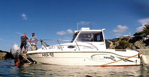
Figure 1. Biofilm Electrochemical Signal variation (%) after the exposure to different concentrations of fluoxetine (1, 2, 4, 8 and 10 mg/L) for 5, 15, 30 and 40 minutes.
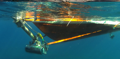
Figure 2. Main components of the biofilm-based biosensor: a biofilm conditioning unit, a signal transduction and processing module, and a data transmission system.
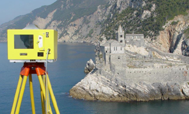
Figure 3. Representative electrochemical signal profile of biofilm development, highlighting seasonal-dependent variations during its formation. Specifically, biofilm develops after about 5, 9, 16 and 12 days in summer, autumn, winter, and spring, respectively. Each biofilm growth event was followed by cleaning of sensor and re-immersion.
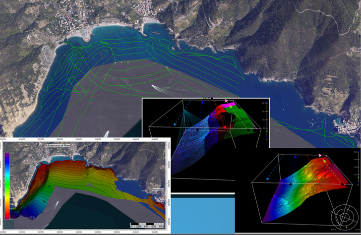
This screenshot shows some visualization of data collected in Monterosso (La Spezia)
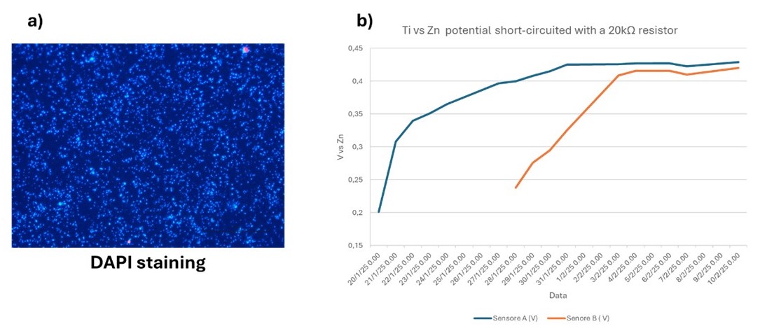
Figure 3. a) Biofilm colonization revealed through DAPI staining; b) biofilm electrochemical activity.
According to literature, electrochemical biosensors could provide rapid, sensitive, simple and low-cost measurements to assess overall toxicity in water samples by converting biological stress responses into quantifiable electrical signals (Gao et al. 2016; Hui et al. 2022). Our findings further indicate that this biofilm-based EWS offers several advantages, including i) real-time marine environment monitoring, ii) low maintenance requirements, iii) potential for serial assembly, iv) high stability, and v) low cost. These features make it particularly advantageous compared to molecule- and tissue-based biosensors, as biofilm forms spontaneously on the electrode surface and exhibits a longer operational lifespan, without the need for periodic renewal of the biological component. In addition, the possibility of assembling multiple sensors simultaneously ensures the continuous availability of biofilms in their “activated and responsive” phase, in accordance with seasonal temperature fluctuations. In conclusion, we highlight the potential of biofilm-based sensor for marine monitoring. However, long-term investigations are needed to validate these results and to evaluate the robustness, reliability, and accuracy of this innovative EWS under different environmental conditions and stressors, in order to support their potential integration into environmental monitoring programs at national and international level.
Rilievo batimetrico
Rilievo fotogrammetrico
Studio scientifico
Bosman A, Anzidei M, Trippanera D, Greco M, Raso E, Vecchio A, Alberti T, Carmisciano C, Georgiadis C, Chiappini M, et al. The First Relative Sea Level Rise and Storm Surges Scenarios up to 2150 CE for the Coasts of Monterosso and Vernazza, Cinque Terre National Park (Liguria, Italy). Remote Sensing. 2026; 18(11):1735. https://doi.org/10.3390/rs18111735
Comunicato stampa
Rassegna stampa
Cinque Terre, il mare avanza: Monterosso e Vernazza a rischio entro il 2150. Lo studio
Le Cinque Terre sempre più esposte all’aumento del livello del mare”: lo studio
Cinque Terre 2150: nuovi scenari di innalzamento del mare e mareggiate per Monterosso e Vernazza
Innalzamento mare, perle delle Cinque Terre come Monterosso e Vernazza potrebbero essere sommerse
Cinque Terre, l’innalzamento del mare mette a rischio le coste di Monterosso e Vernazza
Il mare divora le Cinque Terre onde di 13 metri minacciano Monterosso e Vernazza